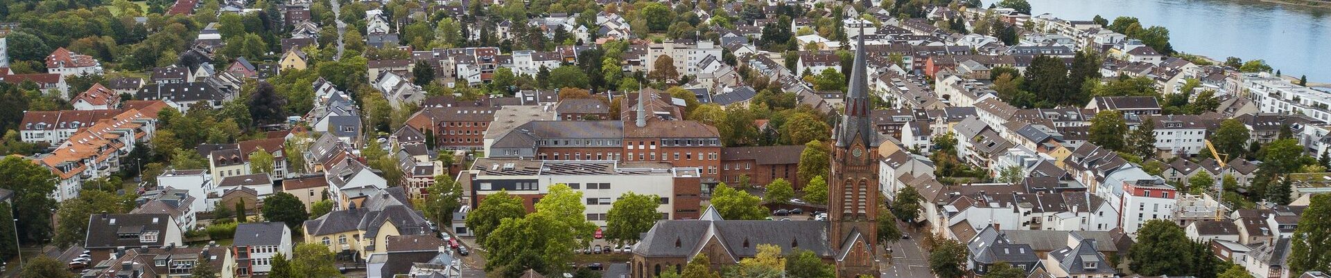
Bonn on the right bank of the Rhine, the "Schäl Sick", is rightly known as the sunny side of Bonn. Where there is a lot of sun, there is also a lot of shade, as the saying goes, and in relation to Beuel, this means that the shadows of the past were still on the right bank of the Rhine.
When Bonn on the left bank of the Rhine had long been a proud city of Churköln grace, it was still quite rural between the Siegniederung and Dollendorfer Hardt. This rural character of the district has survived the industrialization of the 19th century and the granting of city rights in 1952. In addition to the beauty of the landscape, this "rurality" still gives Bonn on the right bank of the Rhine its special charm today. However, it was quite different factors that determined the development of Beuel and its surroundings.
First of all, there is the geographical location: the location at the intersection of ancient trade routes led to the settlement of the area on the Rhine and Sieg as early as prehistoric times. In the first century, the Germanic tribes replaced a mixed Celtic-Roman population, the Romans regarded the lowlands to the right of the Rhine as a glacis and the Franks later used this area as one of their starting points for ending Roman rule in German lands. However, the fact that Caesar is said to have built the first bridge over the Rhine between Bonn and Beuel belongs to the realm of legend; Drusus is more likely.
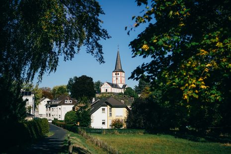
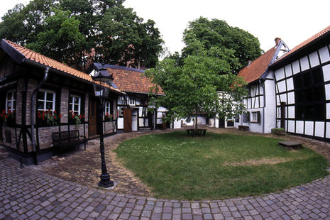
However, the northern part of Bonn's urban area has always been an important Rhine crossing. The natural east-west connection and the Siegtal valley have predestined the confluence area for this. It is interesting to note that the ferry rights were almost always on the Beuel side. Roman military land became royal property, royal property became noble and church property. The district of Beuel owes one of the most important Romanesque monuments on the Rhine to Count Arnold von Wied: the double church at Schwarzrheindorf. As Archbishop of Cologne, he consecrated the double church in 1151 in the presence of the German ruler, King Konrad III of Hohenstaufen. This was certainly the most glamorous day in the history of the "Schäl Sick". Imperial visits, however, have remained episodes in the history of the district. Appearances by Napoleon, who is said to have planted an oak tree on the Finkenberg above Limperich, and Haile Selassi, who paid his respects to the double church in Schwarzrheindorf, are much more recent. However, from the Middle Ages to the 19th century, ruling this area was very much a matter of politics.
The builder of the Romanesque double church in Schwarzrheindorf, Archbishop Arnold von Wied, secured a bastion for himself and his successors with the monastery attached to the church and later a noble ladies' convent, which, together with Vilich Monastery, founded as early as the 10th century, was the mainstay of Churköln rule on the right bank of the Rhine for a long time. An outstanding representative of this convent is St. Adelheid, who was born around 970 and was a canoness of St. Ursula's Abbey in Cologne. She transformed the canoness convent in Vilich into a Benedictine monastery and dedicated her life to caring for the poor and sick. The increasing veneration of St. Adelheid and the pilgrimage to her laid the foundations for one of the largest fairs in Germany, the Pützchens Markt. On January 27, 1966, Adelheid is canonized by Pope Paul VI. This makes her the only saint of the city of Bonn, of which she is the patron saint. Her feast day is celebrated on February 5.
Beuel has been a divided community for many centuries. It was not until Napoleon united the Churköln and Bergisch parts of today's district (with the exception of Oberkassel and Holzlar) to form the Mairie Vilich. After 1850, in Prussian times, this became the municipality of Vilich, the forerunner of the later town of Beuel.
On February 4, 1952, the Beuel municipal council instructed the administration to apply to the Ministry of the Interior for the granting of city rights. In April of the same year, the district council submitted this application to the regional council. 28 April 1952: the municipal council approved the design of a city coat of arms - ferryboat and 13 stars - and chose blue and yellow as the city colors. On July 7, 1952, a memorandum prepared by the administration was submitted to the state cabinet. On August 24, 1952, the state cabinet granted city rights to the municipality of Beuel.
Oberkassel in the south and Holzlar and Hoholz in the east were joined to the Beuel urban area in 1969.